KH-M100A (I-95L, GT-95, iCAREU )

The contents of the log file in the device are as seen below.
GPRMC,202826.002,A,3750.6884,N,02750.5390,E,0.00,,240605,,,A*77
traccar gps server log as shown below (test port 5001):
gps103 < ip] $GPRS,myimei(15character),,,0418,0058,99,0,0,20050806,075443,N,375040.77,E,275032.56,0,0*2A
$GPRMC - Recommended Minimum Specific GPS/TRANSIT Data
$GPRMC GPS NMEA sentence: https://gist.github.com/tomfanning/60f94e547c979907e32030c9df7f1272
**************NMEA 0183 protocol ***************
$GPRMC,170047.00,A,4121.23302,N,00201.31654,W,2.703,   ,200417,   , ,A*64
$GPRMC,hhmmss.ss,A,llll.ll,   a,yyyyy.yy,   a,x.x,  x.x,ddmmyy,x.x,a,m*hh
       |         | |          | |           | |     |   |      |   | | \- Checksum
       |         | |          | |           | |     |   |      |   | \--- Mode indicator, (A=Autonomous, D=Differential, E=Estimated, N=Data not valid)
       |         | |          | |           | |     |   |      |   \----- E or W of magnetic variation
       |         | |          | |           | |     |   |      \--------- Magnetic variation degrees (Easterly var. subtracts from true course)
       |         | |          | |           | |     |   \---------------- UTC date of fix
       |         | |          | |           | |     \-------------------- Track made good in degrees True
       |         | |          | |           | \-------------------------- Speed over ground in knots
       |         | |          | |           \---------------------------- E or W of longitude
       |         | |          | \---------------------------------------- Longitude of fix
       |         | |          \------------------------------------------ N or S of longitude
       |         | \----------------------------------------------------- Latitude of fix
       |         \------------------------------------------------------- Data status (A=Valid position, V=navigation receiver warning)
       \----------------------------------------------------------------- UTC time of fix
GPRMC & GPGGA decoder
https://rl.se/gprmc
eg2. $GPRMC,225446,A,4916.45,N,12311.12,W,000.5,054.7,191194,020.3,E*68
       225446       Time of fix 22:54:46 UTC
       A            Navigation receiver warning A = OK, V = warning
       4916.45,N    Latitude 49 deg. 16.45 min North
       12311.12,W   Longitude 123 deg. 11.12 min West
       000.5        Speed over ground, Knots
       054.7        Course Made Good, True
       191194       Date of fix  19 November 1994
       020.3,E      Magnetic variation 20.3 deg East
       *68          mandatory checksum

NMEA data is supported on T55 port, but what you showed in your log is not NMEA.
I need the protocol and port number for the product seen in the picture which is sold under different names. Does anyone have information about this issue?
Product Name : GPS TRACKER
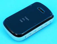
Model No : GT-95
FCC ID : XODTCK950910A
Trade Name iCAREU